

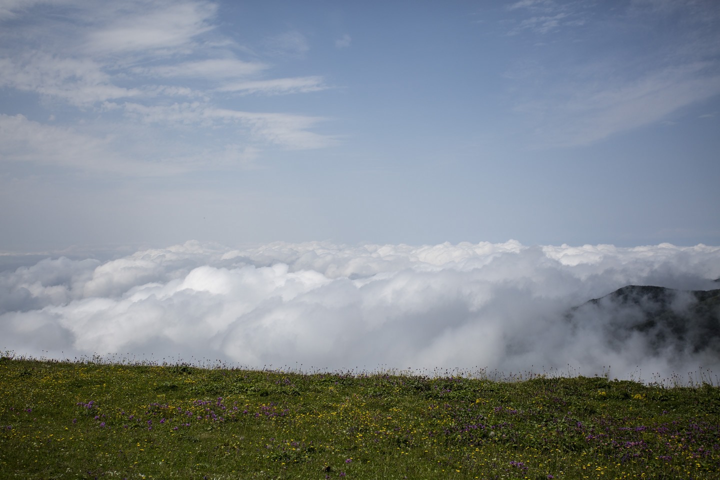
კინტრიშის დაცული ტერიტორია აჭარის ავტონომიურ რესპუბლიკაში, ქობულეთის რაიონში მდებარეობს და მისი საერთო ფართობი 13514 ჰა-ს შეადგენს. იგი მოქცეულია მდინარე კინტრიშის თვალწარმტაც ხეობაში, სოფ. ცხემვანსა და ხინოს მთებს შორის, ზღ. დ.-დან 300-2500 მ-ის სიმაღლეზე. დაცულ ტერიტორიებს ჩრდილოეთით ქობულეთის სატყეოს ადმინისტრაციის ტერიტორიები, სამხრეთ აღმოსავლეთით შუახევის მუნიციპალიტეტის ტერიტორია, სამხრეთით ქედის მუნიციპალიტეტის ტერიტორია, სამხრეთ-დასავლეთით კი მტირალას ეროვნული პარკი ესაზღვრება. კინტრიშის დაცული ტერიტორიების ადმინისტრაცია ორ სხვადასხვა კატეგორიის დაცულ ტერიტორიას – სახელმწიფო ნაკრძალსა და დაცულ ლანდშაფტს მართავს. კინტრიშის სახელმწიფო ნაკრძალი 1959 წელს შუამთის რელიქტური ტყეებისა და ენდემური სახეობების, ფლორისა და ფაუნის დაცვის მიზნით დაარსდა.
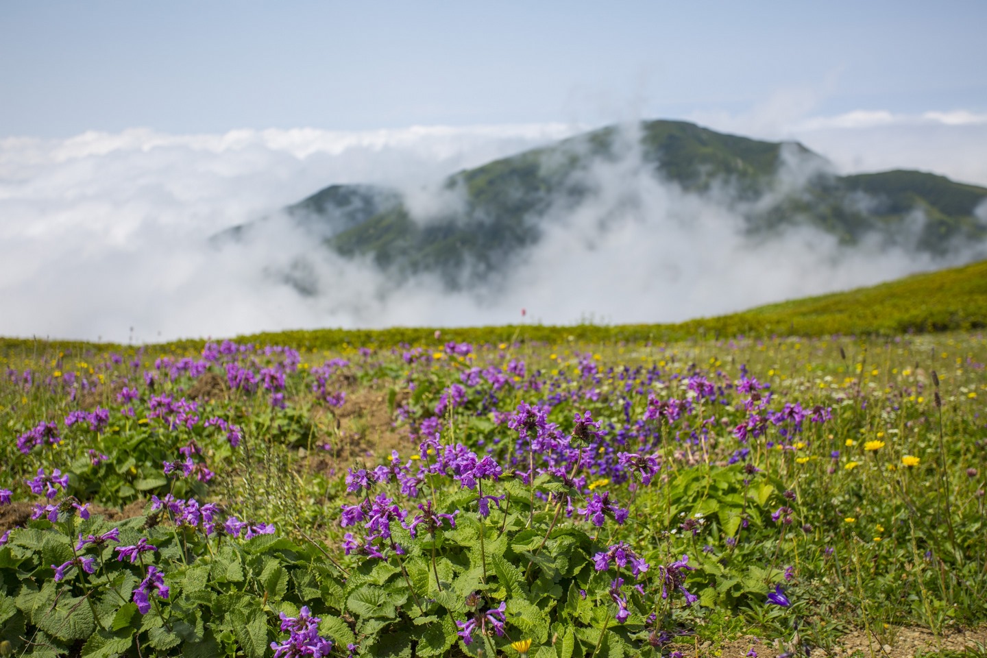
2007 წელს კინტრიშის სახელმწიფო ნაკრძალის ბაზაზე დაცული ლანდშაფტი შეიქმნა. სახელმწიფო ნაკრძალის ფართობია 3108 ჰა, ხოლო ეროვნული პარკის 10406 ჰა. კინტრიშის ორი ტურისტული მარშრუტი მდებარეობს ზღვის დონიდან 300-2000 მ-ის სიმაღლეზე. ბილიკზე გადაადგილება შესაძლებელია როგორც ფეხით, ასევე ცხენით. მარშრუტის გასწვრივ მოწყობილია საპიკნიკე და საკემპინგე ადგილები, ასევე გამოყოფილია კოცონის დასანთები ადგილი. გიდის, ცხენის და ადგილობრივი ტრანსპორტის ორგანიზებაში დაგეხმარებათ დაცული ტერიტორიების ვიზიტორტა ცენტრი.
Kintrishi Protected Areas is located in Adjara Autonomous Republic (Kobuleti Municipality) with a total area of 13,893 ha. It is located in a picturesque valley of the river Kintrishi, between village Tskhemvani and Khino Mountains, at an altitude of 300-2,500 meters above sea level. Protected areas are bordered by Kobuleti forest administration from the north, Shuakhevi municipality area from the east, Qeda municipality from the south, and Mtirala National Park from the south-west. Kintrishi Protected Areas Administration manages two different types of protected areas – State Nature Reserve and Protected Landscape. Kintrishi State Nature Reserve was established in 1959 and its purpose is to protect the relict forest and endemic species, flora, and fauna of Shuamta.
Protected Landscape was established in 2007 on basis of Kintrishi State Nature Reserve: the total area of the nature reserve is 10,703 ha, and protected landscape amounts to 3,190 ha. Kintrishi PAs offers its visitors two tourist trails, both on foot and on a horse. Tourist trails are located 300-2,000 meters above sea level. Picnic and camping places are arranged along trails, fire spots are also allocated. Visitors can visit the area at any time of the year. Visitors center of PAs will help you to organize guide, horse and local transport.
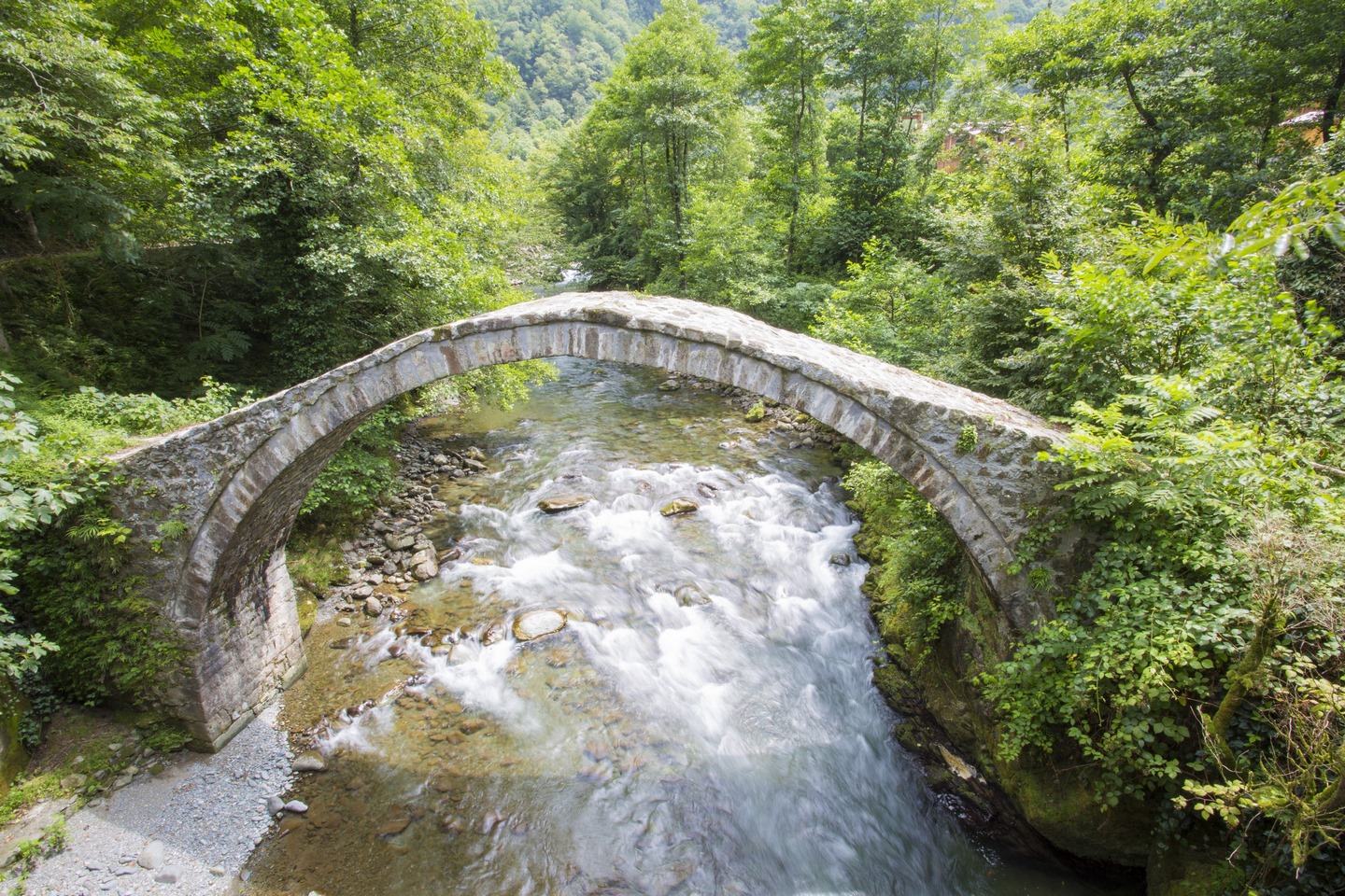
თამარის თაღოვანი ხიდი
/ 1,200 მ, 1.5 სთ, საფეხმავლო, მარტივი /
მარშრუტი იწყება მდინარე კინტრიშის ქვის თაღოვანი ულამაზესი ხიდიდან. ეს ნაგებობა მიეკუთვნება არქიტექტურული ხელოვნების აყვავების – ქვით მშენებლობის განვითარების მეორე პერიოდს (XI-XII სს.) და ითვლება რუსთაველის ეპოქის ძეგლად.
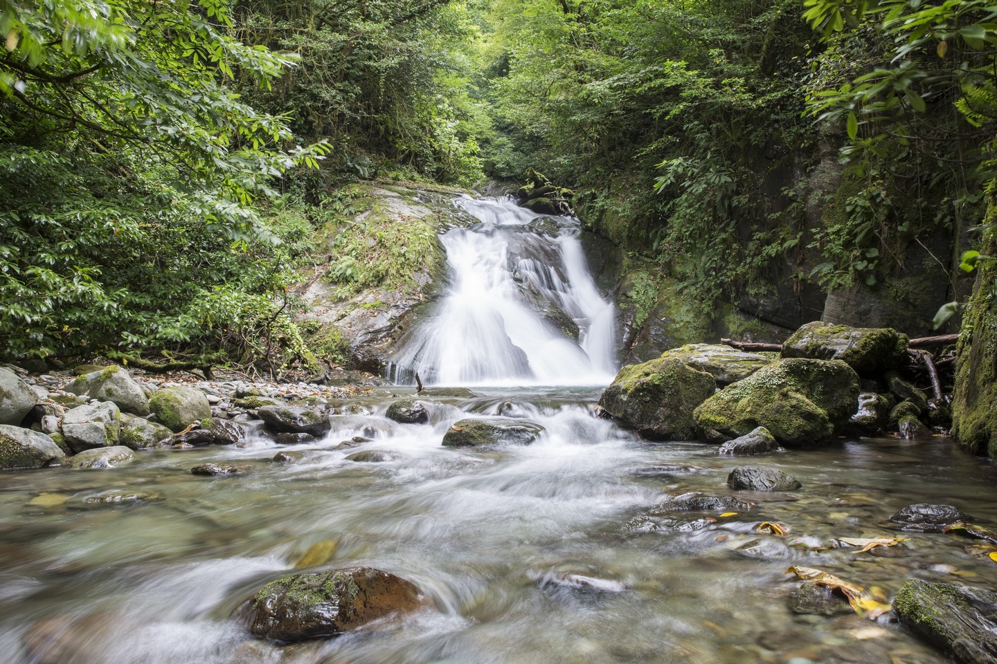
ქვის თაღოვანი ხიდიდან ბილიკი გრძელდება ცხემვანის წმინდა გიორგის სახელობის ეკლესიამდე, რომელმაც ფუნქციონირება 2005 წელს დაიწყო. თავდაპირველად, აქ მამათა მონასტერი იყო, ხოლო 2010 წლიდან გადაკეთდა დედათა მონასტრად. აქვე, ვიზიტორებს შეუძლიათ მოინახულონ უძველესი ღვინის ქვევრები. ბზების კორომები და ჩანჩქერი. თაღოვანი ხიდიდან საფეხმავლო მარშრუტის სიგრძე, დაახლოებით, 600 მეტრია.
ბილიკზე ვიზიტორებს შეუძლიათ ისარგებლონ იქვე არსებული თავშესაფრით, საპიკნიკე და საკარვე ადგილებით.
Tamara arch bridge and Box-tree Stand
/1,200 km, 1.5 hr, pedestrian, difficulty: easy/
Main sightseeing: arched bridge, Tskhemvani St. Giorgi Church, box-tree stands
The trail begins at the arched stone bridge on the Kintrishi River in the village ofTskhemvani. This building belongs to the second period (XI-XII) of the flourishing age of architecture (the development of stone constructions) and is regarded as a monument of the Rustaveli epoch. According to one legend, it is called Tamari Bridge.
The trail continues from the stone arched bridge to the visitor shelter lying in the green nature, where visitors can get full information about the trail, learn about safety rules, and get a trail map. The area is robed with mixed forest (chestnut, beech, hornbeam) stands. Visitors can use camp and picnic spots. The shelter has a hotel where visitors can have a rest, overnight, or rent a horse.
The trails head to Tskhemvani St, Giorgi church, which started functioning in 2005. Initially, there was a Fathers’ Monastery, but since 2010 it has been transformed into a Maternal Monastery. Liturgy is often held there. Prayers especially visit from every corner of Georgia on Christian days. Visitors can see ancient wine pitchers.
The trail continues to old box-tree stands, with a height of 10-12 m and diameter of 16-21 cm.; the forest is more than 300 years. The RushaviRiver flows along with the box-tree stands and at the end of the trail, the waterfall breaks the silence. The length of the path from the arched bridge is approximately 600 m (total – 1,200 m).
უთხოვარი და ტბა ტბიყელი
 / 37 კმ, 2 დღე, საფეხმავლო და საცხენოსნო, საშუალო სირთულის /
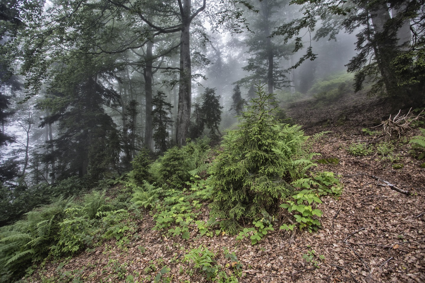
მარშრუტი იწყება ცხემვანის ვიზიტორთა თავშესაფრიდან, სოფ. დიდვაკეში და მიემართება დიდხნოვანი უთხოვრისაკენ, რომელიც მესამეული პერიოდის ერთ-ერთი რელიქტური სახეობაა და საქართველოს წითელ ნუსხაშია შეტანილი. უთხოვარი ერთადერთი წიწვოვანი სახეობაა, რომლის ნაყოფიც არ არის გირჩი.
შემდეგ მარშრუტი გრძელდება ხინოწმინდის ეკლესიის ნანგრევებისაკენ. ეს ეკლესია თავისი მშენებლობის ტექნიკითა და ქვის წყობით მიეკუთვნება VIII-IX საუკუნეებს. ზოგიერთი კედლის ფრაგმენტი 2-3 მ-ს აღწევს. ზომების მიხედვით (18X10) შეიძლება ვიმსჯელოთ, რომ ეკლესია თავის დროზე შედარებით დიდ ნაგებობას წარმოადგენდა.
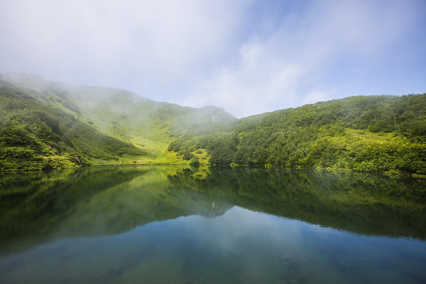
შესვენების შემდეგ, ვიზიტორებს შეუძლიათ გზა განაგრძონ ტბიყელის ტბისაკენ, რომელიც ზღვის დონიდან 1,900-2,000 მეტრის სიმაღლეზე მდებარეობს. ტბას აქვს მოგრძო, ოვალური ფორმა და მისი სიღრმე 7-8 მეტრია. იგი საზრდოობს ატმოსფერული ნალექებით, თოვლის ნადნობითა და გრუნტის წყლებით. ტბა ზამთარში იფარება თოვლით და ყინულით, ტბაში ბინადრობს კავკასიური ტრიტონი, რომელიც წითელ ნუსხაშია შეტანილი. მარშრუტის სიგრძე ეკლესიის ნანგრევებიდან ტბამდე შეადგენს 12 კმ-ს.
Yew and Lake Tbikeli
/ 37 km, 2 days, pedestrian/horse riding, difficulty: average /
Main sightseeing: old yew trees, Khinotsminda church ruins, Lake Tbikeli
The route starts from the Tskhemvani Visitor Shelter and heads to the village of Khino through the villageofDidvake, where we come across old giant yew stands, which are one of the relict species of the tertiary period and which are included in the Georgian Red List. Yew is the only coniferous species whose fruit are not cones. Except for its fruit, every part is poisonous and it includes essential oil and such substances that are poisonous to animals. German scientists consider this yew as 30-40 centuries old.
Afterward, the trail continues to the ruins of the Ninotsminda Church in the village of Khino, which belongs to the VIII-IX centuries with its construction techniques and masonry formation. Some of the wall fragments reach 2-3 meters. According to the measurements (18X10), the church might be considered a relatively large building. The architecture of the KhinotsmindaChurch reveals signs of a relatively late Georgian basilica. Nowadays KhinotsmindaIoaneNatlismtsemeliChurch is functioning and is 44 km from Kobuleti. Visitors can have a rest there and use the picnic spot.
After some break, the visitors can continue on the way to Lake Tbikeli through untouchable chestnut and beech forest, which is located at an altitude of 1900-2000 meters. The lake has an elongated, oval shape, with a depth of 7-8 meters. It is fed by atmospheric precipitation, fused snow, and groundwaters. In winter the lake is covered by snow and ice and is inhabited by Caucasian Newt, which is included in the Red List. The trail distance from the ruins of the church to the lake is 12 km. The tourist shelter on the protected area includes 6 places.
ადგილზე შეგიძლიათ იქირაოთ:
- კარავი -10 ლარი;
- პარალონი – 3 ლარი;
- საძილე ტომარა – 5 ლარი;
- ზურგჩანთა -5 ლარი;
- ცხენი – 50 ლარი; სკოლის მოსწავლეებისა და სტუდენტებისთვის – 30 ლარი;
- საპიკნიკე ადგილი – 1 მაგიდა – 15 ლარი; სკოლის მოსწავლეებისა და სტუდენტებისთვის – 10 ლარი;
- საკარვე ადგილი – 1 ადამიანი – 5 ლარი.
თამარის თაღოვანი ხიდისა და ბზის კორომის ტური ხორცილდება მთელი წლის განმავლობაში, ხოლო უთხოვარი და ტბა ტბიყელის ტური აპრილიდან ნოემბრამდე.
შენიშვნა: სოფ. ცხემვანიდან ხინომდე გადაადგილება შესაძლებელია მხოლოდ მაღალი გამავლობის ავტომანქანით.
განთავსება
- ღამისთევა ტურისტულ თავშესაფარში, სოფ. ცხემვანი: 1 ადამიანი – 15 ლარი; სკოლის მოსწავლეებისა და სტუდენტებისათვის – 10 ლარი.
You can hire:
- Tent: 10Gel
- Camping mat: 3Gel
- Sleeping bag: 5 Gel
- Backpack: 5Gel
- Horse service: per person – 35 Gel; Price for pupils, professional colleges and university students – 20 Gel
- Picnic area: 1 Picnic table – 15 Gel; Pupils, professional colleges and university students: 10 Gel
- Campsite: Per person – 5 Gel
You can enjoy the tour “Tamar arch bridge and Box-tree Stand” the whole year-round. Tourist route: “Yew and Lake Tbikeli”: April-November